Gandon Editions
RE-DRAWING DUBLIN
RE-DRAWING DUBLIN
Couldn't load pickup availability
Share
by Paul Kearns and Motti Ruimy
ISBN 978 0948037 512 360pp (hb) 22.5 x 24.5 cm 360 illus index
ReDrawing Dublin is a story of a city. It is a celebration and affirmation of a city and the people who live there. It is both a visual essay and an act of ‘action urbanism’. ReDrawing Dublin captures a snapshot of Dublin today, reveals glimpses of recent memory and imagines alternative possible futures. This is an urban and suburban journey that walks the streets of Dublin, explores local neighbourhoods and maps the wider city metropolitan region. It opens the door to existing buildings and buildings that never happened, investigates abandoned spaces and the people who inhabited them, aborted skylines and the language that tried to make them happen.
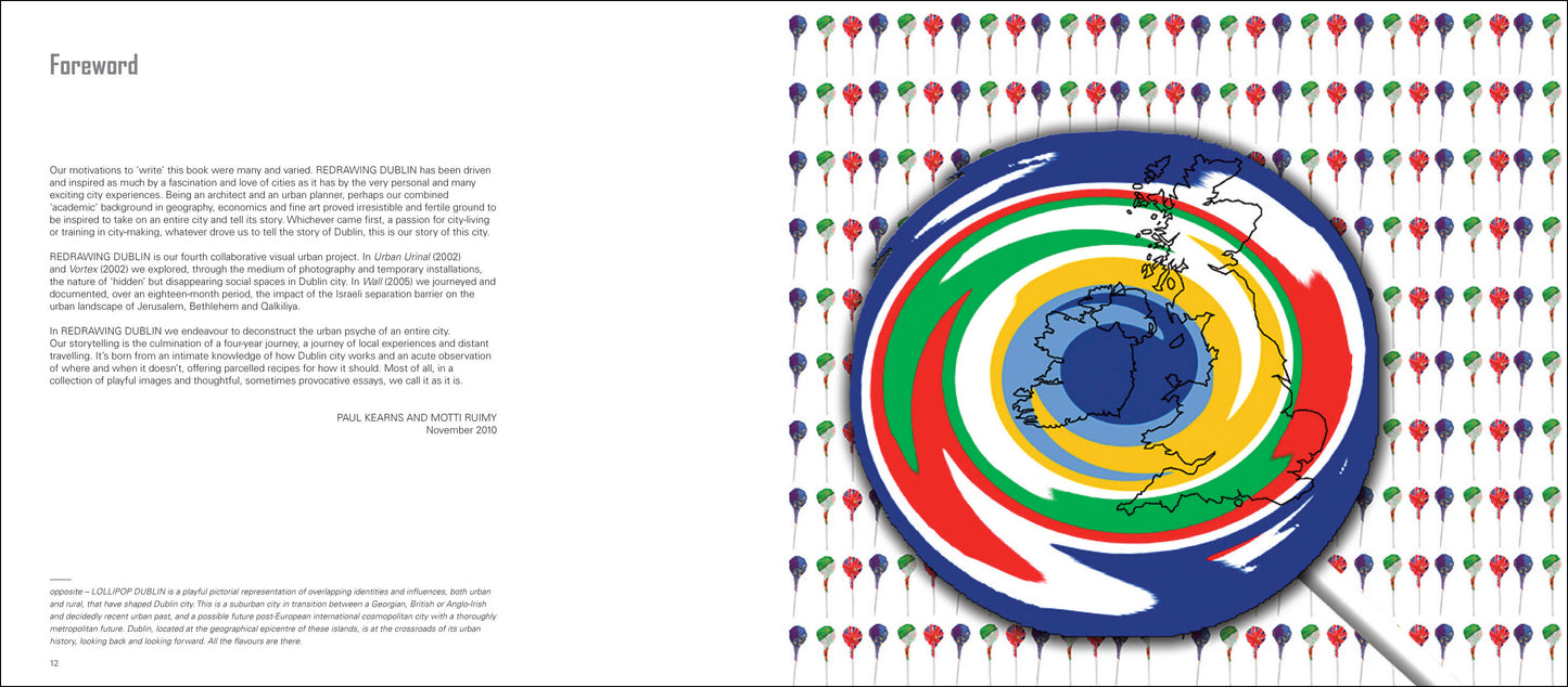
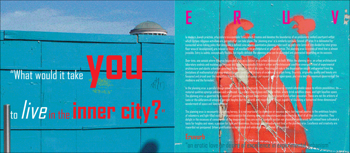
One doesn’t have to know Dublin particularly well to enjoy this book. One doesn’t even have to have visited the city. The story of ReDrawing Dublin is universal, its urban images everyday. ReDrawing Dublin unapologetically promotes real urbanism, celebrates diversity and champions city-living. A strong theme in the book is the inherent tensions between urban and suburban Dublin. Where does the city begin and end? Is Dublin really a Georgian city or a city of two-storey housing? What is the difference between the city centre and the inner city, and why is it desirable to live in one but not the other? At its simplest, the book endeavours to paint an honest picture of a city.
EXTRACT
"In 'Contiguous Metropolitan' we have mapped out those areas in the greater Dublin region that have a minimum population density of 200 people per square kilometre, and also form a contiguous belt of density radiating out from the heart of the capital city. Might this be metropolitan Dublin? Contiguous Metropolitan includes the northern suburban fringes of Co Kildare. This includes an unbroken finger of ‘exurban’ communities of towns and housing estates stretching from Leixlip to Celbridge and Maynooth, but excludes the ‘island’ towns of Naas or Newbridge, the latter better described as Dublin orbital suburban commuter satellites. Similarly, the towns of Arklow to the south, in Co Wicklow, and Skerries to the north, in Fingal, reside outside our metropolitan region. These dormitory towns, home to thousands of ‘Dublin’ commuters, are reasonably densely populated but are disconnected from the city proper either by green fields or low-density industrial estates.In our Contiguous Metropolitan region they exist psychologically independent, just beyond its grip, definition or interest. Contiguous Metropolitan captures the extent to which ‘Dublin’ expanded into neighbouring Meath, Wicklow and Kildare during the Celtic Tiger building boom period. It now extends as far south as Kilcoole in Co Wicklow, some 35km from the centre of the city. Those parts of the ‘exurb’ counties of Kildare, Wicklow, Meath and Fingal that form part of our new Contiguous Metropolitan area make up 59.7% of its land area and 25.8% of its population.
The geographical area of Dublin City Council, on the other hand, accommodates over 40% of the population of Contiguous Metropolitan, and occupies just 14% of its total land area. Our Contiguous Metropolitan Dublin has a population of just over 1.25 million people. Its land area is marginally smaller and its population is marginally greater than Co Dublin itself (797km2 and 1.25 million people, versus 921km2 and 1.19 million). Our metropolitan region thus has a population density of 1,563 people per km2 compared to 1,292 per km2 for Dublin county. So, having defined a version of our extended city, its boundary and its population, how does it compare to other great metropolitan cities globally?
Interestingly, Contiguous Metropolitan Dublin has a similar area to New York City. The five New York boroughs (790km2) are, however, home to 8.3 million people, thus generating a population density of 10,630 people per km2.5 Greater Los Angeles, with a geographic area some 5.4 times greater than Contiguous Metropolitan (4,300km2), manages to accommodate a population 9.4 times greater (11.7 million), generating a population or urban density twice that of our metropolitan Dublin (2,750 per km2).6 It’s difficult not to conclude that the Irish east coast Celtic Tiger building boom has generated or outdone an American-style west coast ‘CO2’ settlement bust – a low-density, car-dependent metropolitan regional sprawl.
Might it have been done any differently? What went wrong? Are there any lessons to be learned? Was it the result of over-zealous land rezonings, weak regional planning structures, inept local planning, or does it reflect something much deeper – an Irish love of the front and back garden, a distaste or disinterest for apartment dwellings, and a subconscious distrust of city living?"
— from Chapter 1: Beyond the Pale
|
CONTENTS Foreword 12 |
|
This is a multidimensional Thom's Directory on ‘speed’ which critically, imaginatively, and unapologetically presents a ‘warts and all’ picture of our capital ... the book needs to be seen as a contributor to a radical action plan and change agenda, and not consigned to an aide memoir as to how Dublin was, and Dubliners were – no more bullshit... — Seán Ó Laoire, Irish Arts Review A grounded and questioning work by an architect and a working planner, that transforms the same graphic medium into a significant and thoughtful contribution to the debate about the city... — Niall McCullough, Architecture Ireland
|